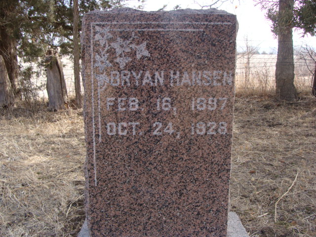
Bryan Hansen was one of a pair of twins of Ottoline Diderikke Madsen AAGAARD Hansen and Niels (Nels/Neils) Hansen. His twin, Lydia Hansen, died a few months after their birth in 1897. He was one of nine children ( seven survived past infancy). He was of medium build, blue eyes and light brown hair.
Reel Cemetery notes and/or description:
Reel Cemetery, remotely located some 7 miles (mostly south) of Missouri Valley, IA, and a few miles east of Honey Creek, IA. Land is owned by Dan Hanson, a farmer. Access can be granted by asking him at 1st farm south of the REEL CEMETERY sign or @ 712-545-3467.
GPS ~ N41.42335 W095.83241 ~ Elev 1172'
the north (on I-29 S / I-680 S)
Depart I-29 S / I-680 S 4.3 mi
At exit 66, take ramp right toward Honey Creek 0.2 mi
Turn left onto Rosewood Rd / CR-L19 Unpaved Road 0.2 mi
Keep straight onto 152nd St Unpaved Road 1.4 mi
Keep straight onto Sumac Rd Unpaved Road 1.1 mi
Turn right onto Old Lincoln Hwy / CR-L20 2.6 mi
Turn left onto Coldwater Ave / CR-L36 0.5 mi
Turn left onto 190th St Unpaved Road
.
Family Members


Sponsored by Ancestry
Advertisement
Explore more
Sponsored by Ancestry
Advertisement