Rhea Family Burial Ground
Freehold Township, Monmouth County, New Jersey, USA
Following is from New Jersey Graveyard and Gravestone Inscription Locators: Monmouth County - Edward J. Raser, 2002:
Age: 1720 - 1767
Size: Nine known stones
Use Status: Relocated
Wear: Excessive
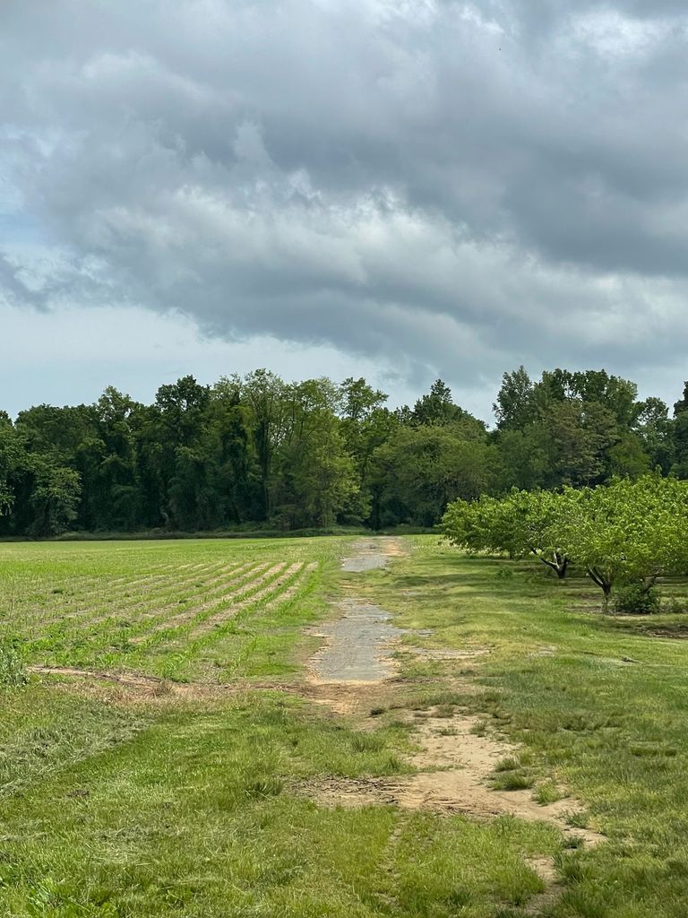
Location: Originally located at a point approximately 1,900 feet due north of highway NJ-33, and 600 feet due west of highway US-9
Comments: Robert Rhea settled in Monmouth County by 1688; he acquired substantial acreage here by 1710. Rhea wrote a will dated 10 April 1718 (NJ Wills, 97-98M) and died 19 Jan 1719. His gravestone, possibly procured years later, is erroneously dated 1720 (the inventory of his estate was taken 27 May 1719). Symmes, 399, provides an early outline of his family.
Ellis, 508, provides some inscription information, but it is so inaccurate as to be useless. He does note that the Rhea farm was in the line of retreat of the British after the Battle of Monmouth, and evidence exists suggesting that Continental troops rested in the Rhea graveyard during the battle. In 1890 James T. Burtis copied the inscriptions; he listed eight stones and noted that "Besides these stones there are several broken into pieces and scattered about the ground. The plow seems to have encroached greatly. This plot is surrounded by an apple orchard". Stillwell, pre-1900, noted that "This plot is situated int he middle of an apple orchard, without fence, and rapidly going in to decay"; his copy in SHGM, 2:318, contains minor inaccuracies. A copy in Symmes, 361, is accurate. On 11 April 1952 Raser found the place under willow trees and surrounded by a wooden fence; only seven stones were seen. In the latter part of 1955 the extant stones, but not the remains, were relocated to Old Tennent Cemetery (Manalapan Township #4) where they were reset about 75 feet west of the church among other Rhea stones originally placed in the churchyard. Photographs of the original graveyard taken on 1 September 1955 can be found in the MCHA photo collection (FR-174 through 176)
The following information was copied by Symmes, checked by Raser in 1952. Stone positions are current ones in Old Tennent Cemetery family lot.
Rhea, David, D. 15 May 1761, aged 64 yrs. & 2 mos. (2-6)
Rhea, David (2-7). Small brownstone, name only. Possibly a child's stone, but also possibly the footstone of David Rhea, d. 1761
Rhea, Janet, d. 15 Jan. 1761, aged about 93 years (2-2)
[Rhea, Jonathan d. 23 May 1767, aged 31 (or 35), 9.1 Already broken in to fragments when copied by Burtis and Stillwell.
[Rhea, Jonathan* ; wife Lydia*; dau. Anna, d. aged 5 mos., dates not give.] Stone seen in 1938, missing in 1952
Rhea, Robert, d. 18 Jan 1720, age not given (2-1)
Rhea, Robert*; wife Mary*; dau. Margaret [sic] d. 10 Nov 1747, aged 1.3.7 (1-7); son David, d. 11 Aug 1752 aged 3.11.25 (1-5); dau. Margaret [sic], d 16 Aug 1752, aged 1.6.7 (1-3)
Following is from New Jersey Graveyard and Gravestone Inscription Locators: Monmouth County - Edward J. Raser, 2002:
Age: 1720 - 1767
Size: Nine known stones
Use Status: Relocated
Wear: Excessive
Location: Originally located at a point approximately 1,900 feet due north of highway NJ-33, and 600 feet due west of highway US-9
Comments: Robert Rhea settled in Monmouth County by 1688; he acquired substantial acreage here by 1710. Rhea wrote a will dated 10 April 1718 (NJ Wills, 97-98M) and died 19 Jan 1719. His gravestone, possibly procured years later, is erroneously dated 1720 (the inventory of his estate was taken 27 May 1719). Symmes, 399, provides an early outline of his family.
Ellis, 508, provides some inscription information, but it is so inaccurate as to be useless. He does note that the Rhea farm was in the line of retreat of the British after the Battle of Monmouth, and evidence exists suggesting that Continental troops rested in the Rhea graveyard during the battle. In 1890 James T. Burtis copied the inscriptions; he listed eight stones and noted that "Besides these stones there are several broken into pieces and scattered about the ground. The plow seems to have encroached greatly. This plot is surrounded by an apple orchard". Stillwell, pre-1900, noted that "This plot is situated int he middle of an apple orchard, without fence, and rapidly going in to decay"; his copy in SHGM, 2:318, contains minor inaccuracies. A copy in Symmes, 361, is accurate. On 11 April 1952 Raser found the place under willow trees and surrounded by a wooden fence; only seven stones were seen. In the latter part of 1955 the extant stones, but not the remains, were relocated to Old Tennent Cemetery (Manalapan Township #4) where they were reset about 75 feet west of the church among other Rhea stones originally placed in the churchyard. Photographs of the original graveyard taken on 1 September 1955 can be found in the MCHA photo collection (FR-174 through 176)
The following information was copied by Symmes, checked by Raser in 1952. Stone positions are current ones in Old Tennent Cemetery family lot.
Rhea, David, D. 15 May 1761, aged 64 yrs. & 2 mos. (2-6)
Rhea, David (2-7). Small brownstone, name only. Possibly a child's stone, but also possibly the footstone of David Rhea, d. 1761
Rhea, Janet, d. 15 Jan. 1761, aged about 93 years (2-2)
[Rhea, Jonathan d. 23 May 1767, aged 31 (or 35), 9.1 Already broken in to fragments when copied by Burtis and Stillwell.
[Rhea, Jonathan* ; wife Lydia*; dau. Anna, d. aged 5 mos., dates not give.] Stone seen in 1938, missing in 1952
Rhea, Robert, d. 18 Jan 1720, age not given (2-1)
Rhea, Robert*; wife Mary*; dau. Margaret [sic] d. 10 Nov 1747, aged 1.3.7 (1-7); son David, d. 11 Aug 1752 aged 3.11.25 (1-5); dau. Margaret [sic], d 16 Aug 1752, aged 1.6.7 (1-3)
Nearby cemeteries

Freehold Township, Monmouth County, New Jersey, USA
- Total memorials9k+
- Percent photographed91%
- Percent with GPS70%

Freehold Township, Monmouth County, New Jersey, USA
- Total memorials84
- Percent photographed29%
- Percent with GPS23%
Freehold, Monmouth County, New Jersey, USA
- Total memorials1
- Percent photographed0%
- Percent with GPS0%

Freehold Township, Monmouth County, New Jersey, USA
- Total memorials752
- Percent photographed99%
- Percent with GPS22%
- Added: 27 May 2022
- Find a Grave Cemetery ID: 2753900

Cemetery Photos
This is a carousel with slides. Use Next and Previous buttons to navigate, or jump to a slide with the slide dots. Use Escape keyboard button or the Close button to close the carousel.
Success
Uploading...
Waiting...
Failed
This photo was not uploaded because this cemetery already has 20 photos
This photo was not uploaded because you have already uploaded 5 photos to this cemetery
This photo was not uploaded because you have already uploaded 5 photos to this cemetery
Invalid File Type
Birth and death years unknown.
1 photo picked...
2 photos picked...
Uploading 1 Photo
Uploading 2 Photos
1 Photo Uploaded
2 Photos Uploaded
Size exceeded
Too many photos have been uploaded
"Unsupported file type"
• ##count## of 0 memorials with GPS displayed. Double click on map to view more.No cemeteries found