Samuel McGehee Sr. Cemetery
Liberty, Amite County, Mississippi, USA
About
-
- Cemetery ID:
Members have Contributed
Advertisement
Photos


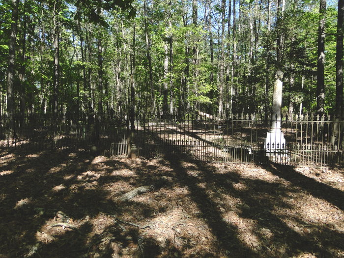
DIRECTIONS to the Samuel McGehee Cemetery: Take the Meadville Road to the North out of Liberty, Mississippi, until you reach New Zion Baptist Church (on the left side of Meadville Road). Drive about 1/4th mile past the church to the first old logging road on the left (west). The old road looks more like a wide path now. There is a rusted iron pipe gate running across the logging road. Go over this iron pipe gate to a barbed wire fence. The top strand of the barbed wire fence is removable. Walk on the old logging road (path) about 3/10th's of one mile, looking to the right as you are walking. The cemetery is about 50 to 75 feet to the right, back in the woods off the logging road (path). There is an ornate wrought iron fence around the cemetery.
DIRECTIONS to the Samuel McGehee Cemetery: Take the Meadville Road to the North out of Liberty, Mississippi, until you reach New Zion Baptist Church (on the left side of Meadville Road). Drive about 1/4th mile past the church to the first old logging road on the left (west). The old road looks more like a wide path now. There is a rusted iron pipe gate running across the logging road. Go over this iron pipe gate to a barbed wire fence. The top strand of the barbed wire fence is removable. Walk on the old logging road (path) about 3/10th's of one mile, looking to the right as you are walking. The cemetery is about 50 to 75 feet to the right, back in the woods off the logging road (path). There is an ornate wrought iron fence around the cemetery.
Nearby cemeteries

Amite County, Mississippi, USA
- Total memorials45
- Percent photographed100%
- Percent with GPS96%

Liberty, Amite County, Mississippi, USA
- Total memorials30
- Percent photographed53%
- Percent with GPS0%
Brookside, Amite County, Mississippi, USA
- Total memorials5
- Percent photographed100%
- Percent with GPS0%
Zion Hill, Amite County, Mississippi, USA
- Total memorials5
- Percent photographed0%
- Percent with GPS0%
- Added: 4 Apr 2012
- Find a Grave Cemetery ID: 2444297

Cemetery Photos
This is a carousel with slides. Use Next and Previous buttons to navigate, or jump to a slide with the slide dots. Use Escape keyboard button or the Close button to close the carousel.


Success
Uploading...
Waiting...
Failed
This photo was not uploaded because this cemetery already has 20 photos
This photo was not uploaded because you have already uploaded 5 photos to this cemetery
This photo was not uploaded because you have already uploaded 5 photos to this cemetery
Invalid File Type
Birth and death years unknown.
1 photo picked...
2 photos picked...
Uploading 1 Photo
Uploading 2 Photos
1 Photo Uploaded
2 Photos Uploaded
Size exceeded
Too many photos have been uploaded
"Unsupported file type"
• ##count## of 0 memorials with GPS displayed. Double click on map to view more.No cemeteries found