Sledge Family Cemetery
Montgomery County, Mississippi, USA
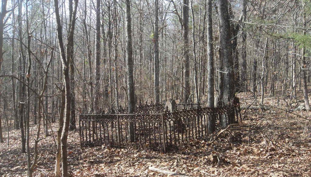
On the old Charlie Campbell farm NE of Duck Hill go about 1 mile north of Duck Hill and turn right (east) onto Riley Road. Travel about 1/2 mile and just as you cross the Bogue Creek iron bridge take a right (south) onto an old abandoned public road. Travel .6 mile, a field road turns right, keep straight (left) and continue on past an old house place on the right. At .8 mile another road forks to the right (south), take this road and continue on it. At one mile you will pass an old house place with pecan trees on the right. Just beyond at 1/1 mile, a large oak tree is on the left. Here turn off the road to the right (south) through a gate into a pasture. (It is .8 mile from here on through the "main" road to exit on Riley Road). From this gate travel about 50 yards and turn right (west) around the cedar trees and continue across the pasture in a westerly direction following the ridge for a total from the gate of around .4 mile. At that point, just before reaching the woods, turn left about 90 degrees to a southerly direction. Travel about .15 mile to edge of the woods on your right (west). The edge of the woods in front (to south) will be about 80 to 100 yards further. Stop here and walk into the woods in a direction slightly south of west (250 degrees by compass) about 90 yards along a ridge, and there will be found the two-grave cemetery. A wrought iron fence surrounds the about 5 ft by 8 ft family plot. Sec 30 T 20 N R6E
Copied by Norman L. Ezell. Note: There is no evidence of other graves in the vicinity. There are many sunken holes over the area, but these are left-over fox holes from military maneuvers during World War II training days of Camp McCain.
Nearby cemeteries

Duck Hill, Montgomery County, Mississippi, USA
- Total memorials2
- Percent photographed100%
- Percent with GPS0%

Montgomery County, Mississippi, USA
- Total memorials9
- Percent photographed100%
- Percent with GPS0%

Duck Hill, Montgomery County, Mississippi, USA
- Total memorials3
- Percent photographed100%
- Percent with GPS0%
Duck Hill, Montgomery County, Mississippi, USA
- Total memorials3
- Percent photographed0%
- Added: 22 Feb 2010
- Find a Grave Cemetery ID: 2342915

Cemetery Photos
This is a carousel with slides. Use Next and Previous buttons to navigate, or jump to a slide with the slide dots. Use Escape keyboard button or the Close button to close the carousel.
Success
Uploading...
Waiting...
Failed
This photo was not uploaded because this cemetery already has 20 photos
This photo was not uploaded because you have already uploaded 5 photos to this cemetery
This photo was not uploaded because you have already uploaded 5 photos to this cemetery
Invalid File Type
Birth and death years unknown.
1 photo picked...
2 photos picked...
Uploading 1 Photo
Uploading 2 Photos
1 Photo Uploaded
2 Photos Uploaded
Size exceeded
Too many photos have been uploaded
"Unsupported file type"
• ##count## of 0 memorials with GPS displayed. Double click on map to view more.No cemeteries found