Adkins Family Cemetery
Pactolus, Carter County, Kentucky, USA
About
-
Get directions Everman Creek Road
Hitchins, Kentucky 41143 United StatesCoordinates: 38.37031, -83.00956 - Cemetery ID:
Members have Contributed
Advertisement
Photos

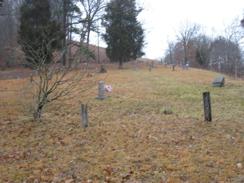
Adkins Cemetery on Everman Creek (GPS: 38 degrees, 22.195 minutes N; 83 degrees, 00.572 minutes W, 685 feet elevation)--Stewart Road intersects Everman Creek Road from the left as one drives up Everman Creek Road. Almost directly across from this intersection, Adkins Cemetery lies on a slope on the right side of Everman Creek Road. It lies within 75 feet or so of Everman Creek Road and is easily visible from the road.
Adkins Cemetery on Everman Creek (GPS: 38 degrees, 22.195 minutes N; 83 degrees, 00.572 minutes W, 685 feet elevation)--Stewart Road intersects Everman Creek Road from the left as one drives up Everman Creek Road. Almost directly across from this intersection, Adkins Cemetery lies on a slope on the right side of Everman Creek Road. It lies within 75 feet or so of Everman Creek Road and is easily visible from the road.
Nearby cemeteries

Carter County, Kentucky, USA
- Total memorials38
- Percent photographed89%
- Percent with GPS0%

Grayson, Carter County, Kentucky, USA
- Total memorials73
- Percent photographed84%
- Percent with GPS0%

Grayson, Carter County, Kentucky, USA
- Total memorials10
- Percent photographed100%
- Percent with GPS0%
Grayson, Carter County, Kentucky, USA
- Total memorials17
- Percent photographed59%
- Percent with GPS0%
- Added: 7 Mar 2009
- Find a Grave Cemetery ID: 2296736

Cemetery Photos
This is a carousel with slides. Use Next and Previous buttons to navigate, or jump to a slide with the slide dots. Use Escape keyboard button or the Close button to close the carousel.

Success
Uploading...
Waiting...
Failed
This photo was not uploaded because this cemetery already has 20 photos
This photo was not uploaded because you have already uploaded 5 photos to this cemetery
This photo was not uploaded because you have already uploaded 5 photos to this cemetery
Invalid File Type
Birth and death years unknown.
1 photo picked...
2 photos picked...
Uploading 1 Photo
Uploading 2 Photos
1 Photo Uploaded
2 Photos Uploaded
Size exceeded
Too many photos have been uploaded
"Unsupported file type"
• ##count## of 0 memorials with GPS displayed. Double click on map to view more.No cemeteries found