Brandhoek Military Cemetery
Vlamertinghe, Arrondissement Ieper, West Flanders, Belgium
About
-
Get directions Grote Branderstraat
Vlamertinghe, Arrondissement Ieper, West Flanders (West-Vlaanderen) BelgiumCoordinates: 50.85317, 2.79114 - Cemetery ID:
Members have Contributed
Advertisement
Photos


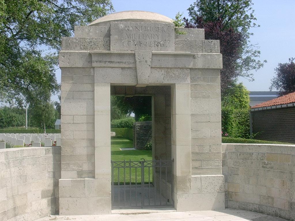
Location Information: Brandhoek Military Cemetery is located 6.5 km west of Ieper town centre on the Branderstraat, a road leading from the N308 connecting Ieper to Poperinge. From Ieper town centre the Poperingseweg (N308) is reached via Elverdingsestraat then directly over two small roundabouts in the J. Capronstraat. The Poperingseweg is a continuation of the J. Capronstraat and begins after a prominent railway level crossing. 6 km along the N308, after passing the village of Vlamertinge and just beyond the church in the hamlet of Brandhoek, lies the left hand turning onto the Grote Branderstraat. The cemetery is located 300 metres along the Branderstraat on the left hand side of the road, beyond the N38 dual carriageway, which it is necessary to cross. Historical Information: During the First World War, Brandhoek was within the area comparatively safe from shell fire which extended beyond Vlamertinghe Church. Field ambulances were posted there continuously and the Military Cemetery was opened early in May 1915 in a field adjoining the dressing station. It closed in July 1917 when the New Military Cemetery was opened nearby, to be followed by the New Military Cemetery No 3 in August 1917. Brandhoek Military Cemetery now contains 669 First World War burials. The cemetery was designed by Sir Reginald Blomfield.
Location Information: Brandhoek Military Cemetery is located 6.5 km west of Ieper town centre on the Branderstraat, a road leading from the N308 connecting Ieper to Poperinge. From Ieper town centre the Poperingseweg (N308) is reached via Elverdingsestraat then directly over two small roundabouts in the J. Capronstraat. The Poperingseweg is a continuation of the J. Capronstraat and begins after a prominent railway level crossing. 6 km along the N308, after passing the village of Vlamertinge and just beyond the church in the hamlet of Brandhoek, lies the left hand turning onto the Grote Branderstraat. The cemetery is located 300 metres along the Branderstraat on the left hand side of the road, beyond the N38 dual carriageway, which it is necessary to cross. Historical Information: During the First World War, Brandhoek was within the area comparatively safe from shell fire which extended beyond Vlamertinghe Church. Field ambulances were posted there continuously and the Military Cemetery was opened early in May 1915 in a field adjoining the dressing station. It closed in July 1917 when the New Military Cemetery was opened nearby, to be followed by the New Military Cemetery No 3 in August 1917. Brandhoek Military Cemetery now contains 669 First World War burials. The cemetery was designed by Sir Reginald Blomfield.
Nearby cemeteries

Vlamertinghe, Arrondissement Ieper, West Flanders, Belgium
- Total memorials553
- Percent photographed92%
- Percent with GPS1%

Vlamertinghe, Arrondissement Ieper, West Flanders, Belgium
- Total memorials977
- Percent photographed92%
- Percent with GPS3%
Arrondissement Brugge, West Flanders, Belgium
- Total memorials0
- Percent photographed0%
- Percent with GPS0%

Vlamertinghe, Arrondissement Ieper, West Flanders, Belgium
- Total memorials29
- Percent photographed100%
- Percent with GPS0%
- Added: 15 Jun 2005
- Find a Grave Cemetery ID: 2145840

Cemetery Photos
This is a carousel with slides. Use Next and Previous buttons to navigate, or jump to a slide with the slide dots. Use Escape keyboard button or the Close button to close the carousel.


Success
Uploading...
Waiting...
Failed
This photo was not uploaded because this cemetery already has 20 photos
This photo was not uploaded because you have already uploaded 5 photos to this cemetery
This photo was not uploaded because you have already uploaded 5 photos to this cemetery
Invalid File Type
Birth and death years unknown.
1 photo picked...
2 photos picked...
Uploading 1 Photo
Uploading 2 Photos
1 Photo Uploaded
2 Photos Uploaded
Size exceeded
Too many photos have been uploaded
"Unsupported file type"
• ##count## of 0 memorials with GPS displayed. Double click on map to view more.No cemeteries found