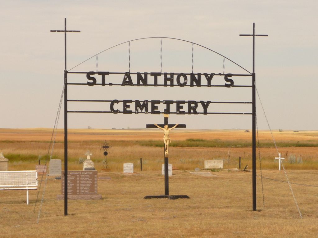
St Anthony Roman Catholic Cemetery
Maleb, Medicine Hat Census Division, Alberta, Canada
About
-
Get directions 90050 HIGHWAY 885
Maleb, Medicine Hat Census Division, Alberta T0K 1K0 CanadaCoordinates: 49.70723, -111.11426 - Cemetery ID:
Members have Contributed
Advertisement
Photos


Travel 18 kilometers south of Highway #3 (Crowsnest Trail)
on Secondary Highway #885.
THE CEMETERY IS AT THE INTERSECTION OF TOWNSHIP ROAD #90 & SECONDARY HIGHWAY #885. IT IS SET BACK FROM THE ROAD BEHIND A VERY OLD ABANDONED CHURCH.
There are 10 graves without permanent markers and only 6 white metal crosses. Since the plot numbers of most of the graves is not known it is impossible to determine whose final resting place each of the white crosses represents.
In 1911 John Leppert died and the 10 acre St Anthony Roman Catholic Cemetery location was chosen. Later that year Johanna Greenstein was interred in the cemetery.
Each family donated $50.00 to help build the church in 1912.
53 burials by April 1960. The remains of at least 2 people were disinterred and re-interred in the Hillside Cemetery, Medicine Hat, Alberta. (Rosa Lanz 1887 - Jan 23 1926 and Simon Hammel 1875 Jan 7 1927)
++++++++++++++++++++++++++
Conquerville (also known as Maleb) is an unincorporated community in the County of Forty Mile No. 8, Alberta, Canada. Located 30 miles (48 km) north of Highway 61, in southeast Alberta, Canada. It is one of many ghost towns along the historic Red Coat Trail route.
Settlers arrived in 1908/09. Conquerville was first established in the early 20th century, the area previously having been used by ranchers along the McLeod Trail, en route to Fort McLeod. The route, which had been converted into a railway during the 1890s, brought many passengers and ranchers nearby Conquerville, including coal miners after coal was discovered in the area early in the 20th century. In 1909, Conquerville underwent an agricultural boom, which brought many farmers to the area. The First World War brought prosperity to Conquerville, with the 1915–16 harvest benefiting all; however, the post-war period saw the town fall on harsh times. Disease ravaged the local cattle population, and Spanish influenza destroyed many families. Grants to farmers, coupled with land grants to new residents supported by the government, led to a rebound for the prairie town. In 1945, a large Conquerville school opened, combining nine different school districts into one. In 1954, the town was electrified, and in 1965 the town celebrated its 50th anniversary of its founding, publishing a book, Conquerville: a growing community, to celebrate.
Ghost town
Starting in the 1980s, Conquerville began to fall into decline. During the 1980s, the local high school – the heart of the community – was closed down due to a lack of enrollment. A basketball court, a reminder of the high school that once stood, remains, but it is overgrown with weeds. Although a community hall remains nearby, only few residents remain. It is believed that the farming community of the area began its fall when the school closed.
The County of Forty Mile provides maintenance in most cemeteries within the County with the exception of the Village of Foremost, Town of Bow Island, Burdett Cemetery and all Hutterite Cemeteries. Maintenance is performed on 28 Cemeteries across the County and consists of mowing grass twice a season, trimming or planting of trees and maintaining appearance of fences and signs.
Nearby cemeteries

Etzikom, Medicine Hat Census Division, Alberta, Canada
- Total memorials17
- Percent photographed100%
- Percent with GPS0%

Maleb, Medicine Hat Census Division, Alberta, Canada
- Total memorials16
- Percent photographed100%
- Percent with GPS0%

Bow Island, Medicine Hat Census Division, Alberta, Canada
- Total memorials10
- Percent photographed80%
- Percent with GPS0%

Whitla, Medicine Hat Census Division, Alberta, Canada
- Total memorials39
- Percent photographed69%
- Percent with GPS0%
- Added: 23 Jul 2014
- Find a Grave Cemetery ID: 2548158

Cemetery Photos
This is a carousel with slides. Use Next and Previous buttons to navigate, or jump to a slide with the slide dots. Use Escape keyboard button or the Close button to close the carousel.


Success
Uploading...
Waiting...
Failed
This photo was not uploaded because this cemetery already has 20 photos
This photo was not uploaded because you have already uploaded 5 photos to this cemetery
This photo was not uploaded because you have already uploaded 5 photos to this cemetery
Invalid File Type
Birth and death years unknown.
1 photo picked...
2 photos picked...
Uploading 1 Photo
Uploading 2 Photos
1 Photo Uploaded
2 Photos Uploaded
Size exceeded
Too many photos have been uploaded
"Unsupported file type"
• ##count## of 0 memorials with GPS displayed. Double click on map to view more.No cemeteries found