Baker Cemetery
Foster Falls, Wythe County, Virginia, USA
About
-
Get directions Baker Island Road
Foster Falls, Virginia 24313 United StatesCoordinates: 36.89762, -80.84597 - Cemetery ID:
Members have Contributed
Advertisement
Photos


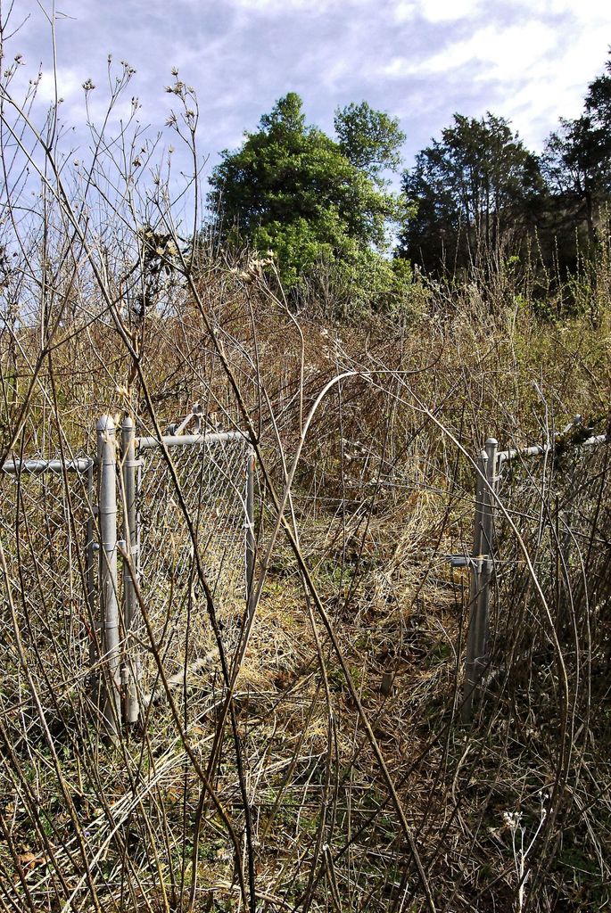
The cemetery is on the uphill side of the power line road, surrounded by a chain link fence and is extremely over-grown (machete required). No headstones are visible from the nearby gravel roadway due to heavy brush both inside and outside the fence. 6-10 ft Blackberry bushes and small locust trees are predominate; both varieties being dangerously thorny. Local residents report AP has cleared the cemetery at least one time in the past.
There are several large trees in the cemetery, one being a huge Holly tree. No recent graves were observed with 1944 being the latest!
Access: About 2 1/2 miles from highway 52, on state road 608 is a marked school bus turn-around (where the hardtop turns into dirt). Across SR608 from the bus turn-around are 2 unnamed, unnumbered roads. The road to the left is marked "Private-No Trespassing". Avoid this road. Take the other road. Access to the cemetery is about 3/4 mile from state route 608 via a dirt road which will turn to grass. From the grass road, bear right onto the power line gravel road and the cemetery will be immediately on your right.
Note: The power line road is accessible from other locations but this is the most direct route.
Nearby cemeteries

Max Meadows, Wythe County, Virginia, USA
- Total memorials4
- Percent photographed50%
- Percent with GPS0%
Foster Falls, Wythe County, Virginia, USA
- Total memorials20
- Percent photographed80%
- Percent with GPS0%

Bertha, Wythe County, Virginia, USA
- Total memorials11
- Percent photographed64%
Barren Springs, Wythe County, Virginia, USA
- Total memorials4
- Percent photographed100%
- Percent with GPS0%
- Added: 14 Sep 2013
- Find a Grave Cemetery ID: 2512533

Cemetery Photos
This is a carousel with slides. Use Next and Previous buttons to navigate, or jump to a slide with the slide dots. Use Escape keyboard button or the Close button to close the carousel.


Success
Uploading...
Waiting...
Failed
This photo was not uploaded because this cemetery already has 20 photos
This photo was not uploaded because you have already uploaded 5 photos to this cemetery
This photo was not uploaded because you have already uploaded 5 photos to this cemetery
Invalid File Type
Birth and death years unknown.
1 photo picked...
2 photos picked...
Uploading 1 Photo
Uploading 2 Photos
1 Photo Uploaded
2 Photos Uploaded
Size exceeded
Too many photos have been uploaded
"Unsupported file type"
• ##count## of 0 memorials with GPS displayed. Double click on map to view more.No cemeteries found