Doran Cemetery
Springfield, Greene County, Missouri, USA
About
-
Get directions 3036 East Evans Road
Springfield, Missouri 65721 United StatesCoordinates: 37.10217, -93.23817 - Cemetery ID:
Members have Contributed
Advertisement
Photos
No additional photos.
Add PhotosClay Township.
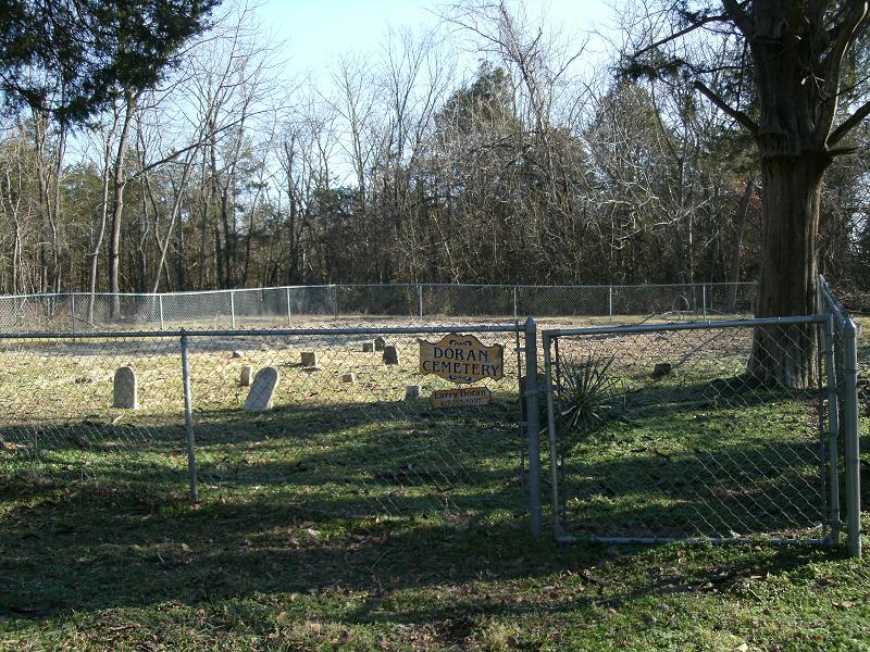
Directions: From US Hiway 65 Springfield, Greene, MO. 2 miles South of 65 and US Hiway 60 Interchange. Use the Evans Rd. exit onto outer road. Evans Road intersects with Farm Rd. 177 on north side of road. On the south side of the road is a privat drive, leading to a private dwelling. Turn into the private dwelling and continue past into a grassy lane which curves west. Follow land approx. 1/4 mile. Cemetery on the north adjacent to the lane covering an area of 45x75 ft. enclosed by chain link fence. Dense ground cover wild blackberry bushes and overgrown forsythia bushes. Old cedar trees in the cemetery. The lane is maintained to give access by auto.
Address given is the approximate address listed with google maps for the location of the driveway.
An alternate way to access the cemetery is from S Southwood Rd approximately 600 feet south of the intersection of S Southwood Rd and Farm Road 188. The cemetery is approximately 250 feet west of S Southwood Rd.
Clay Township.
Directions: From US Hiway 65 Springfield, Greene, MO. 2 miles South of 65 and US Hiway 60 Interchange. Use the Evans Rd. exit onto outer road. Evans Road intersects with Farm Rd. 177 on north side of road. On the south side of the road is a privat drive, leading to a private dwelling. Turn into the private dwelling and continue past into a grassy lane which curves west. Follow land approx. 1/4 mile. Cemetery on the north adjacent to the lane covering an area of 45x75 ft. enclosed by chain link fence. Dense ground cover wild blackberry bushes and overgrown forsythia bushes. Old cedar trees in the cemetery. The lane is maintained to give access by auto.
Address given is the approximate address listed with google maps for the location of the driveway.
An alternate way to access the cemetery is from S Southwood Rd approximately 600 feet south of the intersection of S Southwood Rd and Farm Road 188. The cemetery is approximately 250 feet west of S Southwood Rd.
Nearby cemeteries

Springfield, Greene County, Missouri, USA
- Total memorials10k+
- Percent photographed98%
- Percent with GPS7%

Greene County, Missouri, USA
- Total memorials37
- Percent photographed92%
- Percent with GPS0%

Springfield, Greene County, Missouri, USA
- Total memorials551
- Percent photographed93%
- Percent with GPS65%

Springfield, Greene County, Missouri, USA
- Total memorials115
- Percent photographed98%
- Percent with GPS0%
- Added: 8 Jul 2010
- Find a Grave Cemetery ID: 2361228

Cemetery Photos
This is a carousel with slides. Use Next and Previous buttons to navigate, or jump to a slide with the slide dots. Use Escape keyboard button or the Close button to close the carousel.
Success
Uploading...
Waiting...
Failed
This photo was not uploaded because this cemetery already has 20 photos
This photo was not uploaded because you have already uploaded 5 photos to this cemetery
This photo was not uploaded because you have already uploaded 5 photos to this cemetery
Invalid File Type
Birth and death years unknown.
1 photo picked...
2 photos picked...
Uploading 1 Photo
Uploading 2 Photos
1 Photo Uploaded
2 Photos Uploaded
Size exceeded
Too many photos have been uploaded
"Unsupported file type"
• ##count## of 0 memorials with GPS displayed. Double click on map to view more.No cemeteries found