Shields Cemetery
Shields, Coleman County, Texas, USA
About
-
- Cemetery ID:
Members have Contributed
Advertisement
Photos


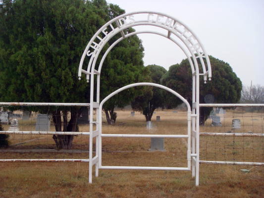
The cemetery is well kept and fenced, with two large entrance gates from the highway. Little of the far east side of the cemetery is in use, as far as is known. Roads run from the first (north) gate west to east, turning south before meeting the east fence, turning back west and running to the second (south) gate. There is a walk-in gate between these two gates.
When Vena Bob Gates and Judia and Ralph Terry surveyed the cemetery for "Coleman County Cemetery Inscriptions, Vol. 2" in 1985, the only cemetery records the cemetery association had was a list, furnished to us by Bernadene McDonald Fowler, who was Secretary/Treasurer of the Shields Cemetery Association. She made these lists from earlier records, but none are known to exist now.
At that time we named the north part, Section A; the part between the two roads, Section B; and the south part, Section C. Row numbers were created for the Shields Cemetery when the cemetery was surveyed in 1988 for "Coleman County Cemetery Inscriptions, Vol. 2." Row numbers were eliminated in the production of this 2022 map and indices, as they are no longer needed for location of a grave, as now each known grave has been given a number. These numbers have been placed on all graves at their actual location on this map, whether the grave has a marker or not. These indices and the map must be used together to be of value.
In some cases, we could not place a name with the proper unknown grave; and in other cases, we could find no sign of a grave as shown by cemetery records. I have included these few graves as "Unknown" in these reocords. Some of these unknown graves may be graves that are also listed by names but their burial locations are not known. A list of graves that are shown by death certificates or other sources is given at the end of the numerical cemetery listing. These graves are not numbered on this map or indices and could be duplicated by graves I have marked as unknown.
Lot numbers were used before 1983, as they were included on lists given us by Bernadene Fowler and were referenced in the "Coleman County Cemetery Inscriptions, Vol. 2." At that time, the cemetery association did not know when these lot numbers came in use, but judging from Bernadene Fowler's 1983 list, lot numbers were first assigned beginning with the oldest grave and continuing to the south through the north and middle sections, returning to the north side with continuous numbering. This method of numbering lots continued to the west. Later additional lots were added to the far east sides of these sections. The south section began to be used about 1933, but the earliest lot number used there was lot 104 for Mrs. Sessions in 1937. New graves of family members were often buried in the lots used by their ancestors. If a person was buried in a new location, a new lot number was assigned. The last lot number shown by Bernadene Fowler is Lot 125, Stoddard McClain, who is buried in Lot 5, with his McClain family. It was apparently becoming confusing to use lot number, so their use was discontinued about that time. Again, as each known grave has been given a number on the map, lot numbers are no longer needed for the location of a grave and have not been shown in these indices. I have included a copy of Bernadene Fowler's 1983 list following the new map indices.
In recent years, there have been several internet websites created that maintain memorials, with pictures, of most cemeteries in the world. I, along with many others, have added memorials for many gravesites, including inurnments, in Coleman County. Thanks to many contributors working together, all the known deceased at the Shields Cemetery have been added to the FindAGrave.com website, which is largest website of this type. All Coleman County Cemeteries are on this website. The Shields Cemetery can be found on this website at: https://www.findagrave.com/cemetery/2149378. During the creation of this 2022 Shields Cemetery map and indices, I have added pictures, memorial numbers and locations, as given in these indices, to each person buried at the Shields Cemetery, and each can be viewed on FindAGrave.com. I have also added the 2022 map in the photo section of the Shields Cemetery on FindAGrave and each memorial can be located on the map and in the cemetery using the memorial number and map coordinates. Verses, marriage dates, military service information, lodge affiliation, and other genealogical type inscriptions shown on markers were not included in these indices, as they were made for use by the cemetery association as a guide to grave location and space allocation and not as a genealogical reference. If this type of information is needed, please consult that person's memorial on the FindAGrave.com website.
Some graves have markers which are shared; that is, the marker contains the names and information of two persons or more, usually a husband and wife. The surname, which usually appears on this type marker only once, has been shown before each person's name for identification in these indices. The map will indicate two reference numbers, when there are two graves, but only one marker. We have also placed reference numbers for reserved graves when there is a marker in place with names inscribed or have been reported to and recorded by the Shields Cemetery Association. We have done this because sometimes it cannot be verified if the person is living, or if the person is deceased with no death date inscribed. There are a few cases of markers being placed and both persons are still living. These reserved spaces have also been given a reference number.
This map was not drafted to scale. A vertical aerial photograph was initially used to determine the locations of the fence, curbs and larger tombstones, then a field survey was done for accuracy. Details such as widths of curbs, exact size of markers, and exact variations of rows off true north to south and east to west alignment are not indicated. Curbs have been drawn as narrow lines. The outside fence of the cemetery has been shown as a broader line. Grave markers are shown as lines of varying lengths, depending on the size of the grave marker, but are not to scale. Temporary markers, such as bricks, rocks and funeral home markers (FHM) have been shown as short lines. Unmarked graves are shown as dots.
Nearby cemeteries

Coleman County, Texas, USA
- Total memorials73
- Percent photographed96%
- Percent with GPS21%

Gouldbusk, Coleman County, Texas, USA
- Total memorials824
- Percent photographed68%
- Percent with GPS7%

Coleman, Coleman County, Texas, USA
- Total memorials800
- Percent photographed97%
- Percent with GPS26%
- Added: 25 Jul 2005
- Find a Grave Cemetery ID: 2149378

Cemetery Photos
This is a carousel with slides. Use Next and Previous buttons to navigate, or jump to a slide with the slide dots. Use Escape keyboard button or the Close button to close the carousel.


Success
Uploading...
Waiting...
Failed
This photo was not uploaded because this cemetery already has 20 photos
This photo was not uploaded because you have already uploaded 5 photos to this cemetery
This photo was not uploaded because you have already uploaded 5 photos to this cemetery
Invalid File Type
Birth and death years unknown.
1 photo picked...
2 photos picked...
Uploading 1 Photo
Uploading 2 Photos
1 Photo Uploaded
2 Photos Uploaded
Size exceeded
Too many photos have been uploaded
"Unsupported file type"
• ##count## of 0 memorials with GPS displayed. Double click on map to view more.No cemeteries found