Arthur Cemetery
Also known as Arthur-Melugin Cemetery , New Arthur Cemetery
Avilla, Jasper County, Missouri, USA
About
-
- Cemetery ID:
Members have Contributed
Advertisement
Photos


The first known burial in what is now Arthur Cemetery was Samuel Melugin in 1852. In 1841 Jasper County Missouri was formed and in 1842 Samuel was the 1st elected State Representative from the newly formed county. He also served a 2nd term in 1848. At the time, the burial was almost certainly on private property, possibly owned by Samuel's neighbor, Thomas Driver. The location was a beautiful, peaceful valley, likely with no aspirations at the time of becoming a neighborhood cemetery.
Prior to the civil war a few additional burials were made in the location, most appear to be members of the Driver family.
Additional burials began to be made at the location following the civil war; records held by the present cemetery association indicate that during these years the cemetery was known as "Drivers Cemetery". By the 1880's the cemetery was being managed by an association of that name and the property was owned by T.J. and Nettie Rickner.
In 1887, the Rickner's deeded the cemetery to the association, trustee's at the time were T.E. Melugin (son of Samuel), E. Quinn (son-in-law of Samuel), and J.T. Driver (son of Allen).
Nettie Rickner was a daughter of Lilburn Arthur, a well-known early settler in the area. Details of the property transfer appear lost to history, but following this transaction the cemetery became known as "Arthur Cemetery". Ironically, as far as is known, Lilburn Arthur's second wife, Mary, is the only ‘Arthur' buried in the cemetery. Lilburn is buried 5 miles away at the "Old Arthur Cemetery", east of Avilla, Missouri, near where he resided much of his life.
Over time the cemetery became a neighborhood burial location, with many family connections. Most numerous names are Melugin, Snyder, Driver, Hawthorne, McAshland, Baldwin and Baley. Presently there are 147 known burials in the cemetery, but there are reports of a number of others, which are unmarked and unlocated.
In 1954 the cemetery association was reorganized. Directors selected at that time were Elgan Snyder, Clyde Ralston, and Bert Bailey. In 1965 Ray Neely replaced Bert Bailey. These men served as caretakers of the cemetery for many years, most of them until their death.
Research into the history of the cemetery is continuing.
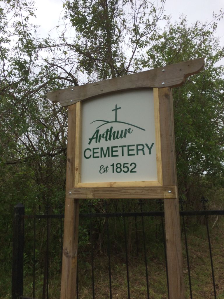
Following 1887, and throughout the 20th century the cemetery was always known as ‘Arthur' Cemetery. This is documented by numerous printed obituaries and death certificates, as well as the cemetery association's records and legal filings. In the early 2000's it was suggested to the County Board of Cemeteries that sometime confusion existed between the old Arthur family cemetery and Arthur Cemetery. Accordingly they had a road sign placed at the lane that read "Arthur-Melugin Cemetery", Melugin being the most prominent list of burials here.
When the Board of Directors of the Arthur Cemetery Association was reorganized in early 2020 one of the first motions approved was to make an effort to see the cemetery recognized by its historical and legal name. Recently, with the approval of members of the county board the ‘Arthur-Melugin' sign was removed and replaced with the corrected signage.
Current cemetery Directors are Dennis Bowers, Rusty Snyder, and Louis Taylor.
The cemetery can be reached by going west of Avilla, Missouri on Highway 96 for one mile then going south on Highway 37 for one mile then west about 1/2 mile on Ivy Road. The cemetery is south of Ivy, down a long lane. Watch for the signage, the lane is narrow and can be difficult to see if you pass quickly.
The first known burial in what is now Arthur Cemetery was Samuel Melugin in 1852. In 1841 Jasper County Missouri was formed and in 1842 Samuel was the 1st elected State Representative from the newly formed county. He also served a 2nd term in 1848. At the time, the burial was almost certainly on private property, possibly owned by Samuel's neighbor, Thomas Driver. The location was a beautiful, peaceful valley, likely with no aspirations at the time of becoming a neighborhood cemetery.
Prior to the civil war a few additional burials were made in the location, most appear to be members of the Driver family.
Additional burials began to be made at the location following the civil war; records held by the present cemetery association indicate that during these years the cemetery was known as "Drivers Cemetery". By the 1880's the cemetery was being managed by an association of that name and the property was owned by T.J. and Nettie Rickner.
In 1887, the Rickner's deeded the cemetery to the association, trustee's at the time were T.E. Melugin (son of Samuel), E. Quinn (son-in-law of Samuel), and J.T. Driver (son of Allen).
Nettie Rickner was a daughter of Lilburn Arthur, a well-known early settler in the area. Details of the property transfer appear lost to history, but following this transaction the cemetery became known as "Arthur Cemetery". Ironically, as far as is known, Lilburn Arthur's second wife, Mary, is the only ‘Arthur' buried in the cemetery. Lilburn is buried 5 miles away at the "Old Arthur Cemetery", east of Avilla, Missouri, near where he resided much of his life.
Over time the cemetery became a neighborhood burial location, with many family connections. Most numerous names are Melugin, Snyder, Driver, Hawthorne, McAshland, Baldwin and Baley. Presently there are 147 known burials in the cemetery, but there are reports of a number of others, which are unmarked and unlocated.
In 1954 the cemetery association was reorganized. Directors selected at that time were Elgan Snyder, Clyde Ralston, and Bert Bailey. In 1965 Ray Neely replaced Bert Bailey. These men served as caretakers of the cemetery for many years, most of them until their death.
Research into the history of the cemetery is continuing.
Following 1887, and throughout the 20th century the cemetery was always known as ‘Arthur' Cemetery. This is documented by numerous printed obituaries and death certificates, as well as the cemetery association's records and legal filings. In the early 2000's it was suggested to the County Board of Cemeteries that sometime confusion existed between the old Arthur family cemetery and Arthur Cemetery. Accordingly they had a road sign placed at the lane that read "Arthur-Melugin Cemetery", Melugin being the most prominent list of burials here.
When the Board of Directors of the Arthur Cemetery Association was reorganized in early 2020 one of the first motions approved was to make an effort to see the cemetery recognized by its historical and legal name. Recently, with the approval of members of the county board the ‘Arthur-Melugin' sign was removed and replaced with the corrected signage.
Current cemetery Directors are Dennis Bowers, Rusty Snyder, and Louis Taylor.
The cemetery can be reached by going west of Avilla, Missouri on Highway 96 for one mile then going south on Highway 37 for one mile then west about 1/2 mile on Ivy Road. The cemetery is south of Ivy, down a long lane. Watch for the signage, the lane is narrow and can be difficult to see if you pass quickly.
Nearby cemeteries

Avilla, Jasper County, Missouri, USA
- Total memorials171
- Percent photographed93%
- Percent with GPS2%


Avilla, Jasper County, Missouri, USA
- Total memorials110
- Percent photographed91%
- Percent with GPS0%

Reeds, Jasper County, Missouri, USA
- Total memorials5
- Percent photographed100%
- Percent with GPS0%
- Added: 3 Nov 2004
- Find a Grave Cemetery ID: 1997634

Cemetery Photos
This is a carousel with slides. Use Next and Previous buttons to navigate, or jump to a slide with the slide dots. Use Escape keyboard button or the Close button to close the carousel.


Success
Uploading...
Waiting...
Failed
This photo was not uploaded because this cemetery already has 20 photos
This photo was not uploaded because you have already uploaded 5 photos to this cemetery
This photo was not uploaded because you have already uploaded 5 photos to this cemetery
Invalid File Type
Birth and death years unknown.
1 photo picked...
2 photos picked...
Uploading 1 Photo
Uploading 2 Photos
1 Photo Uploaded
2 Photos Uploaded
Size exceeded
Too many photos have been uploaded
"Unsupported file type"
• ##count## of 0 memorials with GPS displayed. Double click on map to view more.No cemeteries found