Cloud Chief Cemetery
Cloud Chief, Washita County, Oklahoma, USA
About
-
- 580-660-2284
- Cemetery ID:
Members have Contributed
Advertisement
Photos

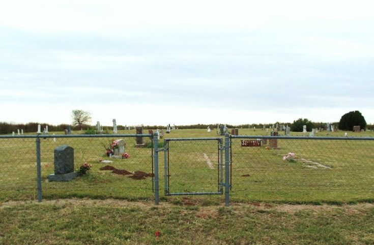
From Cordell, Ok, 7 miles Easton Hwy 152, then south on Hwy 54 for 3 1/2 miles, and ½ mile west.
Located in Segar Township; Legal description: SE ¼ Section 23, Township 9 N, Range 16 W.
The land was homesteaded by David Palmenter and in September 1902, he sold the land to Rua L. Good with the understanding that 5 acres would be used for a cemetery and he could have certain plots in the cemetery.
Nearby cemeteries

Cordell, Washita County, Oklahoma, USA
- Total memorials226
- Percent photographed97%
- Percent with GPS2%

Lake Valley, Washita County, Oklahoma, USA
- Total memorials364
- Percent photographed93%
- Percent with GPS1%
Cloud Chief, Washita County, Oklahoma, USA
- Total memorials0
- Percent photographed0%
- Percent with GPS0%

Cordell, Washita County, Oklahoma, USA
- Total memorials66
- Percent photographed92%
- Percent with GPS2%
- Added: 1 Jan 2000
- Find a Grave Cemetery ID: 98186

Cemetery Photos
This is a carousel with slides. Use Next and Previous buttons to navigate, or jump to a slide with the slide dots. Use Escape keyboard button or the Close button to close the carousel.

Success
Uploading...
Waiting...
Failed
This photo was not uploaded because this cemetery already has 20 photos
This photo was not uploaded because you have already uploaded 5 photos to this cemetery
This photo was not uploaded because you have already uploaded 5 photos to this cemetery
Invalid File Type
Birth and death years unknown.
1 photo picked...
2 photos picked...
Uploading 1 Photo
Uploading 2 Photos
1 Photo Uploaded
2 Photos Uploaded
Size exceeded
Too many photos have been uploaded
"Unsupported file type"
• ##count## of 0 memorials with GPS displayed. Double click on map to view more.No cemeteries found