
Monoquet Cemetery
Monoquet, Kosciusko County, Indiana, USA
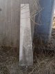
Monoquet Cemetery is located on State Road
15, about 3 miles south of Leesburg. This
cemetery is nicely groomed, but the stones are
becoming unreadable, and many stones
appear to be missing.
The Pottawatomi chiefs were Monoquet, Musquawbuck, Benack, Checose, Mota and Topash. The Miami chiefs were Flat-belly and his brother Wawasee.
The most powerful Indian leaders in 1832 were: Monoquet, whose village consisted of approximately 150 persons; Musquawbuck, who ruled 125; Flat-belly, whose village population was approximately 75; and Wawasee who headed 75 Indians. Chiefs Moto, Checose, Topash and Benack ruled small villages of Indians with a total population of 75, according to Royse. These population figures are not certain. Also in the 1830's there were minor chiefs who led bands of Indians whose reservations boundaries were not definite or stationary, according to Coplen.
Chief Monoquet was a stern man and approximately 57 years old in 1832. His forehead was high and square; his eyes were small and bright; and he was a dark color. He had an aquiline nose, which was uncommon for an Indian to have, and his tenor voice was clear and sharp. He was approximately five feet seven inches tall, according to James W. Armstrong, in the History of Leesburg and Plain Township, Indiana, published by the Leesburg Journal, Leesburg Ind. page 8.
A brief encounter with Monoquet is described in the 1879 county atlas. Metcalf Beck, a Leesburg merchant in 1835 and a local historian, wrote a story about meeting the chief: "He (Monoquet) touched his forehead with the index finger of his right hand and thus addressed me: 'Nin Mon-o-quet,' then brought the hand down with a clap on his thigh and said 'cheep' (the Indians could pronounce no word ending with the sound of the letter "f"). It was a warm Sunday morning in the fall of 1835; his dress was a ruffled shirt of blue calico reaching midway down his thigh, and his feet were clad in moccasins. Our conversation was brief, for neither knew more than seven or eight words of the language of the other. We soon said all we could, then shook hands and parted; each made a bow to the other, and said 'ba-sho-nick', which in English meant 'goodbye.'
Monoquet ruled a tribe of Pottawatomi Indians who were forced to live on a four-section sized reservation located midway between Leesburg and Warsaw with approximately two-thirds of the reservation lying on the west side of State Rd. 15 North and one-third of the reservation lying on the east side of State Rd. 15 North.
Nearby cemeteries

Warsaw, Kosciusko County, Indiana, USA
- Total memorials4
- Percent photographed100%
- Percent with GPS0%

Leesburg, Kosciusko County, Indiana, USA
- Total memorials3k+
- Percent photographed93%
- Percent with GPS1%

Warsaw, Kosciusko County, Indiana, USA
- Total memorials819
- Percent photographed94%
- Percent with GPS1%
Warsaw, Kosciusko County, Indiana, USA
- Total memorials5
- Percent photographed100%
- Percent with GPS0%
- Added: 8 Feb 2008
- Find a Grave Cemetery ID: 2248878

Cemetery Photos
This is a carousel with slides. Use Next and Previous buttons to navigate, or jump to a slide with the slide dots. Use Escape keyboard button or the Close button to close the carousel.
Success
Uploading...
Waiting...
Failed
This photo was not uploaded because this cemetery already has 20 photos
This photo was not uploaded because you have already uploaded 5 photos to this cemetery
This photo was not uploaded because you have already uploaded 5 photos to this cemetery
Invalid File Type
Birth and death years unknown.
1 photo picked...
2 photos picked...
Uploading 1 Photo
Uploading 2 Photos
1 Photo Uploaded
2 Photos Uploaded
Size exceeded
Too many photos have been uploaded
"Unsupported file type"
• ##count## of 0 memorials with GPS displayed. Double click on map to view more.No cemeteries found