Elmira Mennonite Cemetery
Elmira, Waterloo Regional Municipality, Ontario, Canada
About
-
Get directions 68 Church Street West
Elmira, Waterloo Regional Municipality, Ontario CanadaCoordinates: 43.60112, -80.56564 - Cemetery ID:
Members have Contributed
Advertisement
Photos


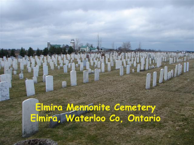
The cemetery dates back to June 1854, when the then-called West Woolwich branch of the Mennonite Church purchased 2 acres/0.8 hectares for a meetinghouse and graveyard. The first burial was of a child, David Foell, who died May 21, 1855. "First grave" is inscribed on the cement base of the gravestone.
The cemetery has been expanded over the years. In 1962, and again in 1989, adjoining land was purchased to enlarge the graveyard.
The largest and oldest section of the cemetery, closest to the meeting house, contains predominantly simple, white gravestones. The inscriptions on the older stones are in German, the language spoken by Mennonites of the area.
Nearby cemeteries

Elmira, Waterloo Regional Municipality, Ontario, Canada
- Total memorials3k+
- Percent photographed95%
- Percent with GPS0%

Elmira, Waterloo Regional Municipality, Ontario, Canada
- Total memorials932
- Percent photographed96%
- Percent with GPS0%

Elmira, Waterloo Regional Municipality, Ontario, Canada
- Total memorials419
- Percent photographed99%
- Percent with GPS1%

Elmira, Waterloo Regional Municipality, Ontario, Canada
- Total memorials25
- Percent photographed100%
- Percent with GPS0%
- Added: 11 Oct 2003
- Find a Grave Cemetery ID: 1971614

Cemetery Photos
This is a carousel with slides. Use Next and Previous buttons to navigate, or jump to a slide with the slide dots. Use Escape keyboard button or the Close button to close the carousel.


Success
Uploading...
Waiting...
Failed
This photo was not uploaded because this cemetery already has 20 photos
This photo was not uploaded because you have already uploaded 5 photos to this cemetery
This photo was not uploaded because you have already uploaded 5 photos to this cemetery
Invalid File Type
Birth and death years unknown.
1 photo picked...
2 photos picked...
Uploading 1 Photo
Uploading 2 Photos
1 Photo Uploaded
2 Photos Uploaded
Size exceeded
Too many photos have been uploaded
"Unsupported file type"
• ##count## of 0 memorials with GPS displayed. Double click on map to view more.No cemeteries found